
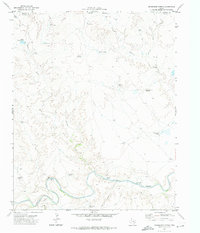
1966 Map of Vat Camp
USGS Topo · Published 1969About this map
The Vat Camp outpost serves as a central reference point in this corner of Oldham County, where the High Plains drop into the breaks of the Canadian River. The landscape is defined by its water sources, essential for ranching operations in the mid-1960s. Named springs such as Chavez Spring and Dripping Springs are scattered throughout the canyon draws, while human-engineered solutions like the West Dam Windmill and Louis Windmill indicate the infrastructure required to sustain livestock away from the primary river. Tributaries like Trujillo Creek and Aqua de Piedra Creek carve through the plateau, creating a complex network of arroyos. This survey documents the era of extensive cattle ranching, showing the placement of windmills, tanks, and fence lines that shaped the local economy before modern irrigation transformed regional land use.
Find a feature on this map
12 named features on this map. Tap any name to fly to it.
Don’t see what you’re looking for? This feature index may not catch every label — zoom into the map to look around manually.
Map Details
Editions of this 1966 Vat Camp Map
This is the sole edition of this map. No revisions or reprints were ever made.
Other maps of this area

1954 · Tucumcari
USGS Topo · 1:250,000

1958 · Tucumcari
USGS Topo · 1:250,000

1966 · Signal Spring
USGS Topo · 1:24,000

1966 · Adrian
USGS Topo · 1:24,000

1966 · Signal Spring SE
USGS Topo · 1:24,000

1966 · Big George Tank
USGS Topo · 1:24,000

1966 · Trujillo Camp
USGS Topo · 1:24,000

1971 · Romero SE
USGS Topo · 1:24,000

1971 · Knoblaw
USGS Topo · 1:24,000
1971 · Humdinger Spring
USGS Topo · 1:24,000