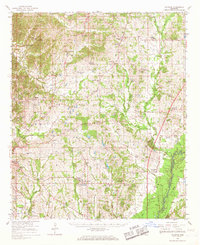
1966 Map of Vaughan
USGS Topo · Published 1967About this map
The Illinois Central railroad corridor anchors the eastern landscape of this Mississippi region, tracing a route through Vaughan and connecting several rural communities near the border of Yazoo and Madison counties. The area is defined by a dense network of country churches and family cemeteries, including St Peters Rock Ch, Christian Grove Ch, and the Strangers Home Cem. These local landmarks, alongside rural schools like Linwood Sch and King Sch, speak to the deep-rooted social fabric of the mid-1960s agricultural countryside.
Find a feature on this map
84 named features on this map. Tap any name to fly to it.
Don’t see what you’re looking for? This feature index may not catch every label — zoom into the map to look around manually.
Map Details
Editions of this 1966 Vaughan Map
2 editions found
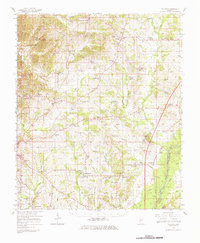
Other maps of this area

1940 · Lexington
USGS Topo · 1:62,500

1940 · Mileston
USGS Topo · 1:62,500

1953 · Meridian
USGS Topo · 1:250,000

1953 · Greenwood
USGS Topo · 1:250,000

1953 · West Point
USGS Topo · 1:250,000

1954 · Mileston
USGS Topo · 1:62,500

1955 · Jackson
USGS Topo · 1:250,000

1956 · Greenwood
USGS Topo · 1:250,000

1957 · Meridian
USGS Topo · 1:250,000

1957 · Lexington
USGS Topo · 1:62,500