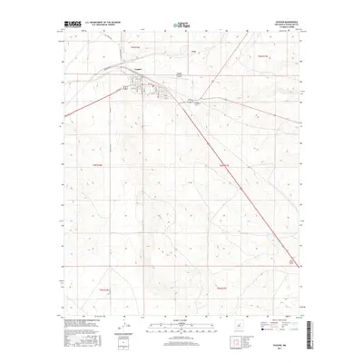
2017 Map of Vaughn
USGS Topo · Published 2017About this map
Vaughn serves as a critical junction in eastern New Mexico, where major transportation corridors intersect across the high plains. This 2017 survey details the town's grid, including residential streets like Magnolia St and Hardie Ave, which branch off from the main thoroughfares. The landscape is characterized by its isolation and the logistical infrastructure required to support it, evidenced by the Vaughn Municipal Airport and the sprawling intersection of regional highways.
Find a feature on this map
33 named features on this map. Tap any name to fly to it.
Don’t see what you’re looking for? This feature index may not catch every label — zoom into the map to look around manually.
Map Details
Editions of this 2017 Vaughn Map
This is the sole edition of this map. No revisions or reprints were ever made.
Other maps of this area

1954 · Fort Sumner
USGS Topo · 1:250,000

1958 · Fort Sumner
USGS Topo · 1:250,000

1978 · Mesa Leon
USGS Topo · 1:24,000

1978 · Santa Barbara Lake
USGS Topo · 1:24,000

1978 · Vaughn
USGS Topo · 1:24,000

1978 · Tejon
USGS Topo · 1:24,000

1978 · Long Draw
USGS Topo · 1:24,000
1978 · Burro Lake
USGS Topo · 1:24,000

1980 · Corona
USGS Topo · 1:100,000

1981 · Gacho Hill NW
USGS Topo · 1:24,000