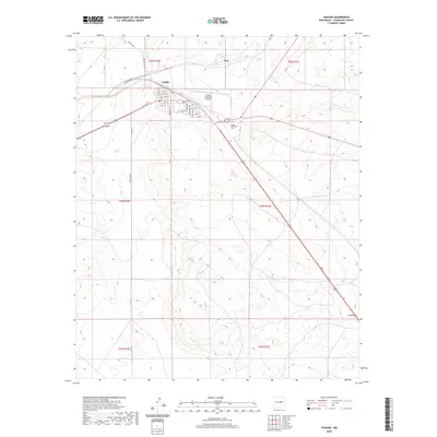
2020 Map of Vaughn
USGS Topo · Published 2020About this map
Vaughn serves as a critical junction in Guadalupe County, where the High Plains landscape is defined by the intersection of major transit corridors and the local street grid. The town's layout is meticulously detailed, showing residential streets from W 11th St down to 2nd St, alongside civic landmarks like the Vaughn Municipal Airport and Vaughn Evergreen Cem. The surrounding terrain, characterized by the wide drainage of Long Draw and the elevation of Mesa De Leon Rd, illustrates the transition between the settlement and the open ranching country. Further north, the small locality of Tony appears along the rail corridor, while roads like Jackalope Rd and Treasure Rd push out into the vast sections of the t5n r16e township, highlighting the grid-based land management that has governed this region since the late 19th century.
Find a feature on this map
32 named features on this map. Tap any name to fly to it.
Don’t see what you’re looking for? This feature index may not catch every label — zoom into the map to look around manually.
Map Details
Editions of this 2020 Vaughn Map
This is the sole edition of this map. No revisions or reprints were ever made.
Other maps of this area

1954 · Fort Sumner
USGS Topo · 1:250,000

1958 · Fort Sumner
USGS Topo · 1:250,000

1978 · Mesa Leon
USGS Topo · 1:24,000

1978 · Santa Barbara Lake
USGS Topo · 1:24,000

1978 · Vaughn
USGS Topo · 1:24,000

1978 · Tejon
USGS Topo · 1:24,000

1978 · Long Draw
USGS Topo · 1:24,000
1978 · Burro Lake
USGS Topo · 1:24,000

1980 · Corona
USGS Topo · 1:100,000

1981 · Gacho Hill NW
USGS Topo · 1:24,000