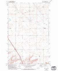
1983 Map of Vaughn NE
USGS Topo · Published 1994About this map
Neuman School stands as a primary landmark in this rural landscape of North Central Montana, where the boundary between Teton Co and Cascade Co divides the high plains. The terrain is characterized by the wide, open expanse of the Flat, a name that reflects the plateau's topography north of the Sun River valley. Infrastructure for water and energy is prominent, with an Aqueduct and a Pipeline cutting across the survey area, tracing the movement of resources through this sparse agricultural region. The drainage of Lake Creek and its associated seasonal Lake provide the primary hydrologic features, marking natural depressions in an otherwise consistent upland environment. This map illustrates the intersection of mid-century infrastructure and traditional rural schooling at a time when small country schoolhouses still punctuated the prairie landscape.
Find a feature on this map
7 named features on this map. Tap any name to fly to it.
Don’t see what you’re looking for? This feature index may not catch every label — zoom into the map to look around manually.
Map Details
Editions of this 1983 Vaughn NE Map
2 editions found
Other maps of this area

1886 · Great Falls
USGS Topo · 1:250,000

1949 · Timber Coulee
USGS Topo · 1:62,500

1949 · Great Falls
USGS Topo · 1:62,500

1949 · Vaughn
USGS Topo · 1:62,500

1950 · Timber Coulee
USGS Topo · 1:62,500

1950 · Dutton
USGS Topo · 1:62,500

1951 · Great Falls
USGS Topo · 1:62,500

1952 · Vaughn
USGS Topo · 1:62,500

1954 · Great Falls
USGS Topo · 1:250,000

1957 · Great Falls
USGS Topo · 1:250,000