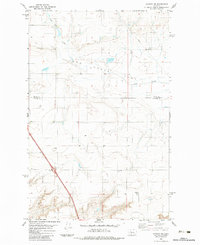
1983 Map of Vaughn NE
USGS Topo · Published 1983About this map
Lake Creek and Flat Creek carve through the high plains of the Montana interior, defining a landscape marked by its expansive open country and gradual topographical shifts. This early 1980s data highlights the rural character of the borderlands between Teton Co and Cascade Co. Education in this sparsely populated region centered on the Neuman School, which stands as a notable landmark for those researching the social history of local farming families. The map reveals a network of roads and pipelines traversing the terrain, reflecting the modern infrastructure required to support agricultural and natural resource activities while preserving the isolation of the northern Great Plains.
Find a feature on this map
4 named features on this map. Tap any name to fly to it.
Don’t see what you’re looking for? This feature index may not catch every label — zoom into the map to look around manually.
Map Details
Editions of this 1983 Vaughn NE Map
2 editions found
Other maps of this area

1886 · Great Falls
USGS Topo · 1:250,000

1949 · Timber Coulee
USGS Topo · 1:62,500

1949 · Great Falls
USGS Topo · 1:62,500

1949 · Vaughn
USGS Topo · 1:62,500

1950 · Timber Coulee
USGS Topo · 1:62,500

1950 · Dutton
USGS Topo · 1:62,500

1951 · Great Falls
USGS Topo · 1:62,500

1952 · Vaughn
USGS Topo · 1:62,500

1954 · Great Falls
USGS Topo · 1:250,000

1957 · Great Falls
USGS Topo · 1:250,000