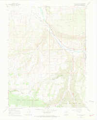
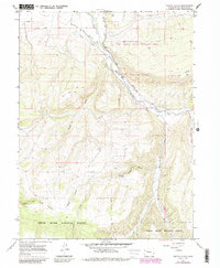
1966 Map of Veatch Gulch
USGS Topo · Published 1969About this map
The White River flows through a landscape defined by ranching infrastructure and high-elevation gulches in this mid-1960s survey of Rio Blanco County. Irrigation is central to the local geography, as evidenced by the Miller Highland Ditch and the Miller Creek Ditch, which trace the contours of the river valley to support mountain agriculture. The southern portion of the map is dominated by the White River National Forest, where the terrain climbs toward Oak Ridge and several prominent drainage systems including Veatch Gulch, Moog Gulch, and Ball Gulch. Extensive networks of Jeep Trails and standard Trails provide access through the national forest boundaries and across various forks of Miller Creek. This map captures a specific era of Western water management and public land use before modern development altered the remote character of these high-country waterways.
Find a feature on this map
18 named features on this map. Tap any name to fly to it.
Don’t see what you’re looking for? This feature index may not catch every label — zoom into the map to look around manually.
Map Details
Editions of this 1966 Veatch Gulch Map
5 editions found
Other maps of this area

1906 · Grand Hogback
USGS Topo · 1:125,000

1910 · Danforth Hills
USGS Topo · 1:125,000

1910 · Grand Hogback
USGS Topo · 1:125,000

1912 · Meeker
USGS Topo · 1:62,500

1914 · Meeker
USGS Topo · 1:62,500

1954 · Craig
USGS Topo · 1:250,000

1957 · Craig
USGS Topo · 1:250,000

1957 · Leadville
USGS Topo · 1:250,000

1958 · Craig
USGS Topo · 1:250,000

1959 · Leadville
USGS Topo · 1:250,000