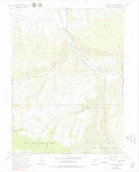
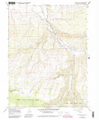
1966 Map of Veatch Gulch
USGS Topo · Published 1979About this map
The White River carves a significant diagonal path through this 1960s Colorado landscape, serving as the primary hydrological anchor for the surrounding high-country terrain. Within the White River National Forest, the map reveals an intricate network of drainage systems, including Veatch Gulch, Moog Gulch, and Bloodsworth Gulch. These natural features are complemented by man-made infrastructure like the Highland Ditch and Park Ditch, which indicate historical water management and irrigation efforts in this high-altitude environment.
Find a feature on this map
19 named features on this map. Tap any name to fly to it.
Don’t see what you’re looking for? This feature index may not catch every label — zoom into the map to look around manually.
Map Details
Editions of this 1966 Veatch Gulch Map
5 editions found
Other maps of this area

1906 · Grand Hogback
USGS Topo · 1:125,000

1910 · Danforth Hills
USGS Topo · 1:125,000

1910 · Grand Hogback
USGS Topo · 1:125,000

1912 · Meeker
USGS Topo · 1:62,500

1914 · Meeker
USGS Topo · 1:62,500

1954 · Craig
USGS Topo · 1:250,000

1957 · Craig
USGS Topo · 1:250,000

1957 · Leadville
USGS Topo · 1:250,000

1958 · Craig
USGS Topo · 1:250,000

1959 · Leadville
USGS Topo · 1:250,000