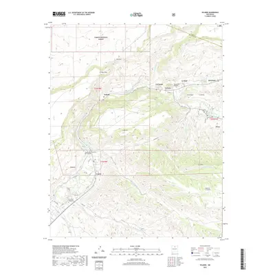
2020 Map of Velarde
USGS Topo · Published 2020About this map
Rio Grande waters carve through the Rio Arriba valley, anchoring a series of historic settlements and agricultural ditches. Near the village of Velarde, the Canova Ditch and Chicos Ditch trace the lower elevations, evidence of the region's enduring acequia heritage. To the north, the terrain rises sharply toward Black Mesa and the boundaries of Carson National Forest, where the landscape is defined by deep arroyos like Cañada Comanche and Cañada de la Entranas.
Find a feature on this map
55 named features on this map. Tap any name to fly to it.
Don’t see what you’re looking for? This feature index may not catch every label — zoom into the map to look around manually.
Map Details
Editions of this 2020 Velarde Map
This is the sole edition of this map. No revisions or reprints were ever made.
Other maps of this area

1918 · Abiquiu
USGS Topo · 1:125,000

1953 · San Juan Pueblo
USGS Topo · 1:24,000

1953 · Lyden
USGS Topo · 1:24,000

1953 · Truchas
USGS Topo · 1:24,000

1953 · Velarde
USGS Topo · 1:24,000

1953 · Trampas
USGS Topo · 1:24,000

1953 · Chimayo
USGS Topo · 1:24,000

1953 · Ojo Caliente
USGS Topo · 1:24,000

1953 · San Juan Pueblo
USGS Topo · 1:62,500

1954 · Raton
USGS Topo · 1:250,000