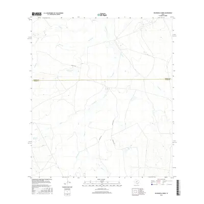
2016 Map of Velenzuela Creek
USGS Topo · Published 2016About this map
Velenzuela Cr and its network of ephemeral tributaries define this South Texas landscape where the boundary between Dimmit and Webb counties bisects the brush country. The map documents a sparsely populated ranching region structured around seasonal water sources and rural access routes like Buena Vista Rd. Significant water management features, including Harrison Lake Number 1, Gates Lake Number 2, and Tiller Lake, suggest the importance of irrigation and livestock tanks in this arid environment. The drainage patterns of Chalker Cr, Tierra Blanca Cr, and Bonito Cr illustrate the natural topography that has dictated land use and property lines since the early ranching era. This survey provides a clear view of the transition from Webb County into the southern reaches of Dimmit County, captured at a time when traditional rural road networks like Ranch Rd 539A remained the primary connectors across the open terrain.
Find a feature on this map
15 named features on this map. Tap any name to fly to it.
Don’t see what you’re looking for? This feature index may not catch every label — zoom into the map to look around manually.
Map Details
Editions of this 2016 Velenzuela Creek Map
This is the sole edition of this map. No revisions or reprints were ever made.
Other maps of this area

1929 · Cotulla
USGS Topo · 1:125,000

1932 · Valley Wells
USGS Topo · 1:62,500

1940 · Asherton
USGS Topo · 1:62,500

1940 · Velenzuela Creek
USGS Topo · 1:62,500

1940 · San Loranzo Creek
USGS Topo · 1:62,500

1940 · Catarina
USGS Topo · 1:62,500

1953 · Crystal City
USGS Topo · 1:250,000

1955 · Crystal City
USGS Topo · 1:250,000

1961 · Crystal City
USGS Topo · 1:250,000

1968 · Crystal City
USGS Topo · 1:250,000