
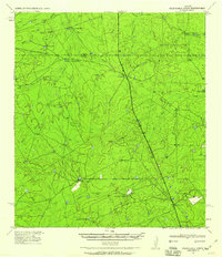
1940 Map of Velenzuela Creek
USGS Topo · Published 1958About this map
The boundary between Dimmit Webb Co. Co. bisects this South Texas landscape, where ranching operations dictated the pattern of settlement in the years leading up to the 1940s. The terrain is defined by a dense network of seasonal drainages, including Velenzuela Creek, Blanco Creek, and Cuchara Creek, which cut through the brush country. Prominent family holdings such as Velenzuela Ranch, Buena Vista Ranch, and Galvan Ranch are documented with their specific ranch houses and supporting structures, providing a clear record of local land ownership. Along the primary north-south route, landmarks like the Hill Top Inn and a designated Roadside Park reflect the era's reliance on automobile travel through this sparsely populated region. Smaller outposts like S Cotulla and the Brewster Ranch further anchor the map, showing how the landscape was managed before modern intensive development.
Find a feature on this map
31 named features on this map. Tap any name to fly to it.
Don’t see what you’re looking for? This feature index may not catch every label — zoom into the map to look around manually.
Map Details
Editions of this 1940 Velenzuela Creek Map
2 editions found
Other maps of this area

1923 · Palafox
USGS Topo · 1:62,500

1927 · Bart
USGS Topo · 1:62,500

1929 · Cotulla
USGS Topo · 1:125,000

1932 · Valley Wells
USGS Topo · 1:62,500

1940 · Asherton
USGS Topo · 1:62,500

1940 · San Loranzo Creek
USGS Topo · 1:62,500

1940 · Catarina
USGS Topo · 1:62,500

1940 · Artesia Wells
USGS Topo · 1:62,500

1953 · Crystal City
USGS Topo · 1:250,000

1955 · Crystal City
USGS Topo · 1:250,000