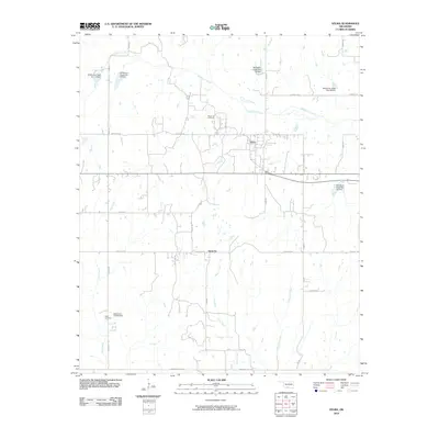
2010 Map of Velma
USGS Topo · Published 2010About this map
Velma and the small community of Santa Fe anchor this region of Stephens County, characterized by a complex network of rural roads and managed water resources. The landscape is defined by the winding course of Wildhorse Creek and its many tributaries, including Pine Creek, Negro Creek, and Boardtree Creek. A significant system of water management is evident through numerous flood control structures such as Wildhorse Creek Site 35 Dam and Wildhorse Creek Site 16 Dam.
Find a feature on this map
33 named features on this map. Tap any name to fly to it.
Don’t see what you’re looking for? This feature index may not catch every label — zoom into the map to look around manually.
Map Details
Editions of this 2010 Velma Map
This is the sole edition of this map. No revisions or reprints were ever made.
Other maps of this area

1901 · Addington
USGS Topo · 1:125,000

1902 · Rush Springs
USGS Topo · 1:125,000

1950 · Marlow
USGS Topo · 1:62,500

1951 · Marlow
USGS Topo · 1:62,500

1957 · Ardmore
USGS Topo · 1:250,000

1963 · Ardmore
USGS Topo · 1:250,000

1963 · Harrisburg
USGS Topo · 1:24,000

1964 · Comanche SE
USGS Topo · 1:24,000
1974 · Pernell
USGS Topo · 1:24,000

1974 · Loco
USGS Topo · 1:24,000