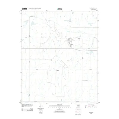
2012 Map of Velma
USGS Topo · Published 2012About this map
Velma serves as the primary hub of this Stephens County landscape, where the grid of residential streets like Comet Ave and Segler St meets the rural agricultural surrounding territory. The area's settlement history is preserved in several local burial grounds, including Velma Cem, Passmore Cem, and Parks Cem to the southwest. Further south, the small community of Santa Fe sits near the intersection of Sunray Rd and n2975 RD.
Find a feature on this map
45 named features on this map. Tap any name to fly to it.
Don’t see what you’re looking for? This feature index may not catch every label — zoom into the map to look around manually.
Map Details
Editions of this 2012 Velma Map
This is the sole edition of this map. No revisions or reprints were ever made.
Other maps of this area

1901 · Addington
USGS Topo · 1:125,000

1902 · Rush Springs
USGS Topo · 1:125,000

1950 · Marlow
USGS Topo · 1:62,500

1951 · Marlow
USGS Topo · 1:62,500

1957 · Ardmore
USGS Topo · 1:250,000

1963 · Ardmore
USGS Topo · 1:250,000

1963 · Harrisburg
USGS Topo · 1:24,000

1964 · Comanche SE
USGS Topo · 1:24,000
1974 · Pernell
USGS Topo · 1:24,000

1974 · Loco
USGS Topo · 1:24,000