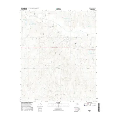
2016 Map of Velma
USGS Topo · Published 2016About this map
Velma and the smaller settlement of Santa Fe anchor this portion of Stephens County, where the landscape is defined by the managed waters of the Wildhorse Cr watershed. The area's agricultural and rural heritage is evident in the network of county roads named for local families and landmarks, such as Santa Fe Rd and Old Hwy 7. The 2016 survey captures a region where natural drainage is supplemented by numerous conservation structures, including Wildhorse Creek Site 16 Reservoir and Wildhorse Creek Site 17 Reservoir. For genealogists and local historians, several burial sites are preserved across the quadrangle, from the larger Velma Cem to smaller family or community plots like Passmore Cem, Old Jackson Cem, and Parks Cem. These sites, along with the meandering paths of Negro Cr and Beardtree Cr, reflect the enduring rural character of south-central Oklahoma.
Find a feature on this map
28 named features on this map. Tap any name to fly to it.
Don’t see what you’re looking for? This feature index may not catch every label — zoom into the map to look around manually.
Map Details
Editions of this 2016 Velma Map
This is the sole edition of this map. No revisions or reprints were ever made.
Other maps of this area

1901 · Addington
USGS Topo · 1:125,000

1902 · Rush Springs
USGS Topo · 1:125,000

1950 · Marlow
USGS Topo · 1:62,500

1951 · Marlow
USGS Topo · 1:62,500

1957 · Ardmore
USGS Topo · 1:250,000

1963 · Ardmore
USGS Topo · 1:250,000

1963 · Harrisburg
USGS Topo · 1:24,000

1964 · Comanche SE
USGS Topo · 1:24,000
1974 · Pernell
USGS Topo · 1:24,000

1974 · Loco
USGS Topo · 1:24,000