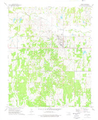
1974 Map of Velma
USGS Topo · Published 1977About this map
The town of Velma serves as the central hub of this mid-1970s Oklahoma landscape, deeply defined by the petroleum industry. Extensive drilling operations are evident throughout the Oil Field and the expansive Loco Field, which together dominate the local economy. Supporting infrastructure, including a large Refinery, a Tank Farm, and several Sewage Disposal Ponds, surrounds the residential core.
Find a feature on this map
21 named features on this map. Tap any name to fly to it.
Don’t see what you’re looking for? This feature index may not catch every label — zoom into the map to look around manually.
Map Details
Editions of this 1974 Velma Map
This is the sole edition of this map. No revisions or reprints were ever made.
Other maps of this area

1901 · Addington
USGS Topo · 1:125,000

1902 · Rush Springs
USGS Topo · 1:125,000

1950 · Marlow
USGS Topo · 1:62,500

1951 · Marlow
USGS Topo · 1:62,500

1957 · Ardmore
USGS Topo · 1:250,000

1963 · Ardmore
USGS Topo · 1:250,000

1963 · Harrisburg
USGS Topo · 1:24,000

1964 · Comanche SE
USGS Topo · 1:24,000
1974 · Pernell
USGS Topo · 1:24,000

1974 · Loco
USGS Topo · 1:24,000