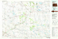
1980 Map of Velva
USGS Topo · Published 1980About this map
The Souris River meanders through this north-central North Dakota landscape, anchoring a region defined by its diverse glacial wetlands and the heavy presence of the Burlington Northern railroad. The 1980 state of the land reflects a significant commitment to conservation, with the J Clark Salyer National Wildlife Refuge and numerous management areas, such as the Heffner Lake State Wildlife Management Area, protecting the vital prairie pothole habitat. These water bodies, including Buffalo Lodge Lake and Round Lake, create a complex mosaic between the small agricultural hubs of Velva, Towner, and Rugby. Local topography is punctuated by features like Copperdahl Hill and the distinct Hogback Ridge, while smaller rail-line settlements such as Verendrye and Karlsruhe mark the historical transit corridors that built the local wheat-farming economy.
Find a feature on this map
82 named features on this map. Tap any name to fly to it.
Don’t see what you’re looking for? This feature index may not catch every label — zoom into the map to look around manually.
Map Details
Editions of this 1980 Velva Map
This is the sole edition of this map. No revisions or reprints were ever made.
Other maps of this area

1929 · Sawyer
USGS Topo · 1:62,500

1929 · Benedict
USGS Topo · 1:62,500

1929 · Kongsberg
USGS Topo · 1:62,500

1929 · Balfour
USGS Topo · 1:62,500

1930 · Drake
USGS Topo · 1:62,500

1940 · Aylmer
USGS Topo · 1:62,500

1941 · Selz
USGS Topo · 1:62,500

1948 · Voltaire
USGS Topo · 1:24,000

1948 · Velva
USGS Topo · 1:62,500

1948 · Sawyer
USGS Topo · 1:24,000