
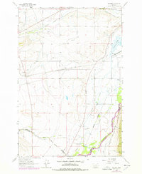
1963 Map of Vendome
USGS Topo · Published 1966About this map
Jefferson River waters dominate the southeastern corner of this landscape, where the confluence of agriculture and industry is visible through an extensive network of irrigation and rail lines. The Chicago Milwaukee St Paul and Pacific railroad cuts across the central territory, passing through the settlement of Vendome, while the Northern Pacific follows the river valley near Renova and Piedmont. These dual rail corridors illustrate the area's importance as a transportation junction during the mid-20th century.
Find a feature on this map
30 named features on this map. Tap any name to fly to it.
Don’t see what you’re looking for? This feature index may not catch every label — zoom into the map to look around manually.
Map Details
Editions of this 1963 Vendome Map
2 editions found
Other maps of this area

1893 · Dillon
USGS Topo · 1:250,000

1955 · Dillon
USGS Topo · 1:250,000

1957 · Dillon
USGS Topo · 1:250,000

1958 · Dillon
USGS Topo · 1:250,000

1960 · Twin Bridges
USGS Topo · 1:62,500

1960 · Waterloo
USGS Topo · 1:62,500

1962 · Dillon
USGS Topo · 1:250,000
1963 · Dry Mountain
USGS Topo · 1:24,000
1963 · Whitehall
USGS Topo · 1:24,000
1963 · Black Butte
USGS Topo · 1:24,000