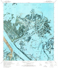
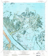
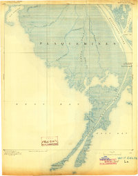
1971 Map of Venice
USGS Topo · Published 1974About this map
Venice stands as a vital outpost at the Mississippi River's terminus, where the heavy industrial infrastructure of the Romere Pass Oil and Gas Field meets the fragile ecology of the Delta National Wildlife Refuge. This 1971 orthophotomap documents a landscape defined by water and engineering, showing the massive Levee protecting the settlement from the Mississippi River. The map captures the complex network of passes and bayous, such as Tiger Pass and Spanish Pass, which serve as the primary conduits for navigation through the delta. Local landmarks like the Full Gospel Ch, the Boothville Cem, and several Radio Towers provide essential navigation and community points in a territory dominated by Sludge Pits and offshore platforms in Breton Sound. The transition from the structured riverfront to the marshy expanse of Jack Bay illustrates the constant interaction between human industry and the shifting Louisiana coastline.
Find a feature on this map
32 named features on this map. Tap any name to fly to it.
Don’t see what you’re looking for? This feature index may not catch every label — zoom into the map to look around manually.
Map Details
Editions of this 1971 Venice Map
2 editions found
Other maps of this area
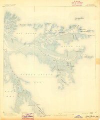
1893 · East Delta
USGS Topo · 1:62,500
1893 · Forts
USGS Topo · 1:62,500
1893 · West Delta
USGS Topo · 1:62,500

1935 · Taylor Pass
USGS Topo · 1:31,680

1946 · Pass Tante Phine
USGS Topo · 1:31,680

1947 · Pass A Loutre West
USGS Topo · 1:31,680
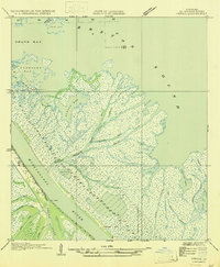
1947 · Venice
USGS Topo · 1:31,680

1947 · Fort St. Philip
USGS Topo · 1:31,680

1947 · Main Pass
USGS Topo · 1:31,680

1948 · Forts
USGS Topo · 1:62,500