
1968 Map of Ventosa
USGS Topo · Published 1971About this map
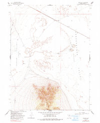
Western Pacific tracks cut diagonally through this high-desert basin in Elko County, centering on the rail siding at Ventosa. The landscape is defined by extensive hydrologic depressions, where runoff from surrounding heights gathers in Clover Valley and Independence Valley. These low-lying areas are characterized by ephemeral water features like The Slough and Little Lake, alongside human interventions for water management such as the Bapt Reservoir. To the south, the terrain rises sharply toward the prominent Spruce Mtn Ridge, terminating at Spruce Point. This 1960s survey illustrates a specialized ranching and transit landscape, where remote outposts like Alkali Flat and vital water sources like Point Spring supported the operations of a sparsely populated interior basin during the mid-twentieth century.
Find a feature on this map
16 named features on this map. Tap any name to fly to it.
Don’t see what you’re looking for? This feature index may not catch every label — zoom into the map to look around manually.
Map Details
Editions of this 1968 Ventosa Map
2 editions found
Other maps of this area

1953 · Spruce Mountain
USGS Topo · 1:62,500

1953 · Spruce Mountain 4
USGS Topo · 1:62,500

1955 · Elko
USGS Topo · 1:250,000

1958 · Elko
USGS Topo · 1:250,000

1962 · Elko
USGS Topo · 1:250,000

1965 · Elko
USGS Topo · 1:250,000

1968 · Independence Valley SW
USGS Topo · 1:24,000

1968 · Snow Water Lake
USGS Topo · 1:24,000
1968 · Snow Water Lake NE
USGS Topo · 1:24,000
1968 · Independence Valley NW
USGS Topo · 1:24,000