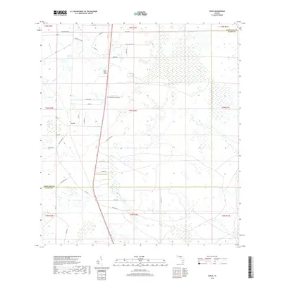
2018 Map of Venus
USGS Topo · Published 2018About this map
The settlement of Venus serves as the focal point for this section of South-Central Florida, where the well-drained soils of the Lake Wales Ridge transition into the surrounding wetlands. This high-ground ridge, a distinctive remnant of ancient shorelines, dominates the northern half of the region and has long supported the area's agricultural and ranching operations. The local infrastructure reflects this pastoral economy, with access provided by Co Rd 731 and numerous family-named routes such as Detjens Dairy Rd and Placid Farms Dr. To the east of the ridge, the landscape opens into broad flatlands characterized by extensive drainage networks and the J H Hendrie Farms Airport. Near the southern boundary, the map documents the transition from Highlands County into Glades County, where rural corridors like Peeples Rd and Woodward Rd cross through low-lying marshlands and prairies.
Find a feature on this map
33 named features on this map. Tap any name to fly to it.
Don’t see what you’re looking for? This feature index may not catch every label — zoom into the map to look around manually.
Map Details
Editions of this 2018 Venus Map
This is the sole edition of this map. No revisions or reprints were ever made.
Other maps of this area

1953 · Brighton NW
USGS Topo · 1:24,000

1953 · Brighton SW
USGS Topo · 1:24,000

1953 · Venus NW
USGS Topo · 1:24,000

1953 · Childs
USGS Topo · 1:24,000

1956 · West Palm Beach
USGS Topo · 1:250,000

1956 · Fort Pierce
USGS Topo · 1:250,000

1957 · West Palm Beach
USGS Topo · 1:250,000

1957 · Venus
USGS Topo · 1:24,000

1957 · Venus SW
USGS Topo · 1:24,000

1958 · Fort Pierce
USGS Topo · 1:250,000