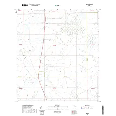
2021 Map of Venus
USGS Topo · Published 2021About this map
Lake Wales Ridge dominates the central elevation of this south Florida landscape, creating a distinct north-south corridor that has historically influenced the area's agriculture and aviation. The small community of Venus serves as the primary settlement hub, positioned west of the ridge amidst a grid of roads named for local families and agricultural operations. Aviation history is grounded here at the J H Hendrie Farms Airport, which sits surrounded by a network of drainage ways including Platt Br. The map reveals a transition into the northern reaches of Glades County, where the terrain shifts toward lower wetlands. Local land use is reflected in names like Detjens Dairy Rd and Placid Farms Dr, indicating the area's continued reliance on cattle and citrus industries along the Lake Wales Ridge line.
Find a feature on this map
38 named features on this map. Tap any name to fly to it.
Don’t see what you’re looking for? This feature index may not catch every label — zoom into the map to look around manually.
Map Details
Editions of this 2021 Venus Map
This is the sole edition of this map. No revisions or reprints were ever made.
Other maps of this area

1953 · Brighton NW
USGS Topo · 1:24,000

1953 · Brighton SW
USGS Topo · 1:24,000

1953 · Venus NW
USGS Topo · 1:24,000

1953 · Childs
USGS Topo · 1:24,000

1956 · West Palm Beach
USGS Topo · 1:250,000

1956 · Fort Pierce
USGS Topo · 1:250,000

1957 · West Palm Beach
USGS Topo · 1:250,000

1957 · Venus
USGS Topo · 1:24,000

1957 · Venus SW
USGS Topo · 1:24,000

1958 · Fort Pierce
USGS Topo · 1:250,000