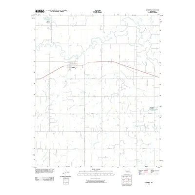
2009 Map of Verden
USGS Topo · Published 2009About this map
Verden occupies a central position in this Oklahoma landscape, situated along a prominent east-west transportation corridor just south of the winding Washita River. The river creates a complex of oxbows and bends across the northern portion of the quadrangle, where it is joined by several tributaries including Spring Creek and Ionine Creek. The southern half of the map is defined by a dense grid of rural roads and an extensive network of drainage features like Rock Hollow Creek and Tony Hollow Creek, which illustrate the region's managed water systems and agricultural layout.
Find a feature on this map
47 named features on this map. Tap any name to fly to it.
Don’t see what you’re looking for? This feature index may not catch every label — zoom into the map to look around manually.
Map Details
Editions of this 2009 Verden Map
This is the sole edition of this map. No revisions or reprints were ever made.
Other maps of this area

1902 · Rush Springs
USGS Topo · 1:125,000

1904 · Chickasha
USGS Topo · 1:125,000

1945 · Anadarko
USGS Topo · 1:62,500

1949 · Cement
USGS Topo · 1:62,500

1949 · Rush Springs
USGS Topo · 1:62,500

1950 · Rush Springs
USGS Topo · 1:62,500

1954 · Oklahoma City
USGS Topo · 1:250,000

1955 · Lawton
USGS Topo · 1:250,000

1955 · Clinton
USGS Topo · 1:250,000

1956 · Laverty
USGS Topo · 1:24,000