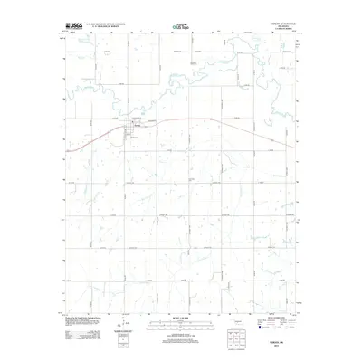
2012 Map of Verden
USGS Topo · Published 2012About this map
Verden serves as the primary hub of this Grady County landscape, where the town's grid meets the meanders of the Washita River. The surrounding prairie is defined by a systematic network of section roads and numerous watercourses, including Rock Hollow Cr and Tony Hollow Cr, which drain the agricultural land. Local history is anchored by several burial grounds, such as the Half Moon Ranch Cem and Plainview Cem, while the Verden Cem sits just south of the main settlement. The northern reaches of the quadrangle feature the Spring Cr Site 103 Reservoir, reflecting the modern water management of Spring Cr. This survey illustrates a rural Oklahoma community that maintains its connection to the river and its original rail-aligned layout along Railroad St.
Find a feature on this map
44 named features on this map. Tap any name to fly to it.
Don’t see what you’re looking for? This feature index may not catch every label — zoom into the map to look around manually.
Map Details
Editions of this 2012 Verden Map
This is the sole edition of this map. No revisions or reprints were ever made.
Other maps of this area

1902 · Rush Springs
USGS Topo · 1:125,000

1904 · Chickasha
USGS Topo · 1:125,000

1945 · Anadarko
USGS Topo · 1:62,500

1949 · Cement
USGS Topo · 1:62,500

1949 · Rush Springs
USGS Topo · 1:62,500

1950 · Rush Springs
USGS Topo · 1:62,500

1954 · Oklahoma City
USGS Topo · 1:250,000

1955 · Lawton
USGS Topo · 1:250,000

1955 · Clinton
USGS Topo · 1:250,000

1956 · Laverty
USGS Topo · 1:24,000