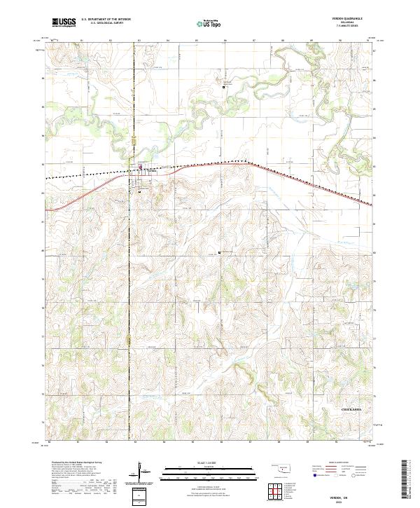
2022 Map of Verden
USGS Topo · Published 2022About this map
Verden sits at the intersection of the Washita River and a local rail corridor, serving as a hub for the agricultural lands of western Oklahoma. The town is situated along Railroad St, where the grid of W Boundry St and Idaho Ave meets the surrounding rural section lines. Evidence of the region’s development is found in the scattered water infrastructure, including the Spring Cr Site 103 Reservoir and the 051032 Reservoir.
Find a feature on this map
40 named features on this map. Tap any name to fly to it.
Don’t see what you’re looking for? This feature index may not catch every label — zoom into the map to look around manually.
Map Details
Editions of this 2022 Verden Map
This is the sole edition of this map. No revisions or reprints were ever made.
Other maps of this area

1902 · Rush Springs
USGS Topo · 1:125,000

1904 · Chickasha
USGS Topo · 1:125,000

1945 · Anadarko
USGS Topo · 1:62,500

1949 · Cement
USGS Topo · 1:62,500

1949 · Rush Springs
USGS Topo · 1:62,500

1950 · Rush Springs
USGS Topo · 1:62,500

1954 · Oklahoma City
USGS Topo · 1:250,000

1955 · Lawton
USGS Topo · 1:250,000

1955 · Clinton
USGS Topo · 1:250,000

1956 · Laverty
USGS Topo · 1:24,000