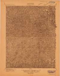
1914 Map of Vergie
USGS Topo · Published 1914About this map
Shelby Creek and the Sandy Valley & Elkhorn RR form the central artery of this eastern Kentucky coalfield landscape at the start of the Great War. The map reveals a dense network of mountain communities and numbered school districts tucked into every hollow and creek bend, including Wales, Virgie, and Yeager. Industrial development is evident in the rail sidings and stations like Penny Sta and Myra Sta, which served the emerging resource extraction economy.
Find a feature on this map
89 named features on this map. Tap any name to fly to it.
Don’t see what you’re looking for? This feature index may not catch every label — zoom into the map to look around manually.
Map Details
Editions of this 1914 Vergie Map
This is the sole edition of this map. No revisions or reprints were ever made.
Other maps of this area

1886 · Prestonsburg
USGS Topo · 1:125,000

1886 · Grundy
USGS Topo · 1:125,000

1887 · Warfield
USGS Topo · 1:125,000

1890 · Whitesburg
USGS Topo · 1:125,000

1890 · Grundy
USGS Topo · 1:125,000

1891 · Warfield
USGS Topo · 1:125,000

1892 · Grundy
USGS Topo · 1:125,000

1892 · Whitesburg
USGS Topo · 1:125,000

1892 · Prestonsburg
USGS Topo · 1:125,000
1912 · Pound
USGS Topo · 1:48,000