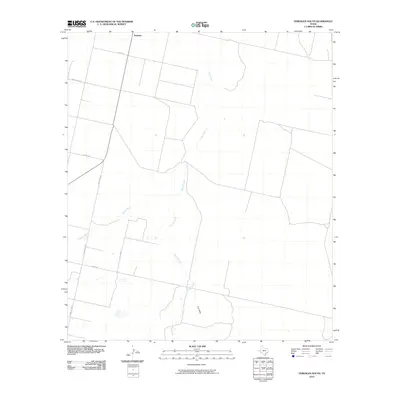
2010 Map of Verhalen South
USGS Topo · Published 2010About this map
Verhalen sits at the northern edge of this West Texas landscape, serving as a focal point for a network of rural roads in Reeves County. The terrain is defined by the intermittent flow of desert watercourses, including the prominent Toyah Creek and Sandia Creek, which carve winding paths across the arid flats. This 2010 survey illustrates the transition of the local infrastructure as older ranching routes like Ranch Rd 2448 and Ranch Rd 3334 connect isolated homesteads and pastures to the small settlement. To the southeast, Cox Draw further illustrates the hydrological patterns that have shaped land use in this part of the Trans-Pecos. The map provides a clear record of the area's grid-like county road system, including Co Rd 330 and Co Rd 308, reflecting the enduring organization of these expansive Texas lands.
Find a feature on this map
10 named features on this map. Tap any name to fly to it.
Don’t see what you’re looking for? This feature index may not catch every label — zoom into the map to look around manually.
Map Details
Editions of this 2010 Verhalen South Map
This is the sole edition of this map. No revisions or reprints were ever made.
Other maps of this area

1894 · Fort Davis
USGS Topo · 1:125,000

1897 · Fort Davis
USGS Topo · 1:125,000

1921 · Toyah
USGS Topo · 1:125,000

1929 · Hovey
USGS Topo · 1:125,000

1931 · Barstow
USGS Topo · 1:125,000

1954 · Pecos
USGS Topo · 1:250,000

1954 · Fort Stockton
USGS Topo · 1:250,000

1955 · Saragosa
USGS Topo · 1:62,500

1957 · Pecos
USGS Topo · 1:250,000

1958 · Fort Stockton
USGS Topo · 1:250,000