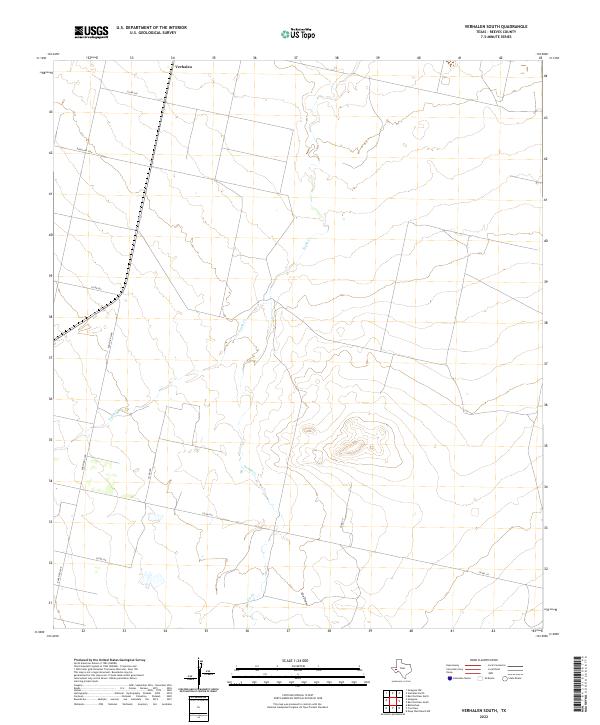
2022 Map of Verhalen South
USGS Topo · Published 2022About this map
Verhalen stands at the northern edge of this West Texas landscape, where the vast desert plains of Reeves County are defined by a network of seasonal watercourses and rural ranch roads. The drainage patterns of the Trans-Pecos region are visible through the winding paths of Toyah Cr and Sandia Cr, which cut through the arid terrain alongside the notable depression of Cox Draw. This modern survey illustrates the expansive land divisions and transportation corridors that sustain the area's ranching economy, including Ranch Rd 2448 and Ranch Rd 3334. The sparse settlement pattern and long stretches of county roads like Co Rd 310 reflect the open-range character of the territory as it appeared in the early twenty-first century.
Find a feature on this map
11 named features on this map. Tap any name to fly to it.
Don’t see what you’re looking for? This feature index may not catch every label — zoom into the map to look around manually.
Map Details
Editions of this 2022 Verhalen South Map
This is the sole edition of this map. No revisions or reprints were ever made.
Other maps of this area

1894 · Fort Davis
USGS Topo · 1:125,000

1897 · Fort Davis
USGS Topo · 1:125,000

1921 · Toyah
USGS Topo · 1:125,000

1929 · Hovey
USGS Topo · 1:125,000

1931 · Barstow
USGS Topo · 1:125,000

1954 · Pecos
USGS Topo · 1:250,000

1954 · Fort Stockton
USGS Topo · 1:250,000

1955 · Saragosa
USGS Topo · 1:62,500

1957 · Pecos
USGS Topo · 1:250,000

1958 · Fort Stockton
USGS Topo · 1:250,000