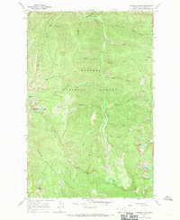
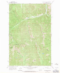
1966 Map of Vermilion Peak
USGS Topo · Published 1970About this map
Kaniksu National Forest and Lolo National Forest meet in this high-elevation wilderness, centered on the drainage of the Vermilion River. Surveyed in the mid-1960s, the landscape is defined by its network of pack trails, such as the Bear Creek Trail and Slide Rock Mountain Trail, which served as the primary transit routes through this roadless terrain. The topography is anchored by prominent summits including Vermilion Peak and Graves Peak, with the continental divide's influence visible in the steep canyons of Ice and Queer Creek. Significant water features like Stony Lake, Terrace Lake, and Marmot Lakes provide markers for backcountry navigation. The transition through Vermilion Pass highlights the historic movement between these two national forests during an era of intensive forest management and preservation.
Find a feature on this map
35 named features on this map. Tap any name to fly to it.
Don’t see what you’re looking for? This feature index may not catch every label — zoom into the map to look around manually.
Map Details
Editions of this 1966 Vermilion Peak Map
2 editions found
Other maps of this area

1937 · Thompson Falls
USGS Topo · 1:125,000

1937 · Thompson Falls
USGS Topo · 1:62,500

1956 · Wallace
USGS Topo · 1:250,000

1957 · Thompson Falls
USGS Topo · 1:62,500

1960 · Wallace
USGS Topo · 1:250,000
1964 · Priscilla Peak
USGS Topo · 1:24,000

1966 · Vermilion Peak
USGS Topo · 1:24,000
1966 · Seven Point Mountain
USGS Topo · 1:24,000
1966 · Miller Lake
USGS Topo · 1:24,000
1966 · Silver Butte Pass
USGS Topo · 1:24,000