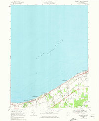
1969 Map of Vermilion West
USGS Topo · Published 1971About this map
Shoreline communities along the southern edge of Lake Erie define this 1969 revision, showing a dense string of beach colonies and summer resorts. From the western edge at Mitiwanga and Ruggles Beach, the landscape is a mix of agricultural land and suburban expansion, divided by the tracks of the Penn Central and Norfolk and Western railroads. These transit lines run parallel to the coast, serving the industrial and commuter needs of the lakefront settlements like Beulah Beach and Volunteer Bay.
Find a feature on this map
36 named features on this map. Tap any name to fly to it.
Don’t see what you’re looking for? This feature index may not catch every label — zoom into the map to look around manually.
Map Details
Editions of this 1969 Vermilion West Map
2 editions found
Other maps of this area

1903 · Vermilion
USGS Topo · 1:62,500

1904 · Sandusky
USGS Topo · 1:62,500

1916 · Kelleys Island
USGS Topo · 1:62,500

1919 · Kelleys Island
USGS Topo · 1:62,500

1956 · Toledo
USGS Topo · 1:250,000

1959 · Milan
USGS Topo · 1:24,000

1959 · Berlin Heights
USGS Topo · 1:24,000

1959 · Vermilion East
USGS Topo · 1:24,000

1959 · Vermilion West
USGS Topo · 1:24,000

1959 · Kipton
USGS Topo · 1:24,000