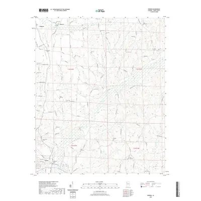
2020 Map of Vernon
USGS Topo · Published 2020About this map
The Lamar County Judicial Center in Vernon anchors this Lamar County landscape, where the administrative heart of the county sits just south of a dense network of family-named landmarks and rural burial grounds. The area is defined by a dendritic drainage system where Yellow Cr, Brush Cr, and Buck Cr carve through the terrain, historically influencing the placement of early settlements like Moscow and Sulligent. Genealogists will find a wealth of specific sites, from the Lamar Memory Gardens near the county seat to isolated points like Morton Chapel Cem and Oakes Chapel Cem. The map illustrates a transition from the structured street grid of Vernon to the winding backcountry routes such as Hankins Bottom Rd and Taylor Springs Rd, reflecting the region's enduring rural character and its reliance on local creek crossings and timberlands.
Find a feature on this map
127 named features on this map. Tap any name to fly to it.
Don’t see what you’re looking for? This feature index may not catch every label — zoom into the map to look around manually.
Map Details
Editions of this 2020 Vernon Map
This is the sole edition of this map. No revisions or reprints were ever made.
Other maps of this area

1953 · Birmingham
USGS Topo · 1:250,000

1953 · West Point
USGS Topo · 1:250,000

1956 · Birmingham
USGS Topo · 1:250,000

1957 · Birmingham
USGS Topo · 1:250,000

1958 · West Point
USGS Topo · 1:250,000

1963 · West Point
USGS Topo · 1:250,000

1967 · Sulligent
USGS Topo · 1:24,000

1967 · Beaverton
USGS Topo · 1:24,000

1967 · Hightogy
USGS Topo · 1:24,000

1967 · Bluff
USGS Topo · 1:24,000