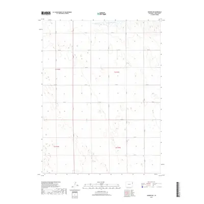
2019 Map of Vernon NW
USGS Topo · Published 2019About this map
The N Fork Republican River cuts across the northern edge of this high plains landscape, defining the hydrology of an otherwise arid agricultural region. This 2019 survey of eastern Yuma County reveals a strictly ordered township-and-range system, where the terrain is segmented by a precise grid of rural thoroughfares including Co Rd 29 and Co Rd 22. The map illustrates the characteristic section-line development of the West, with north-south routes like Co Rd T and Co Rd Y creating a reliable infrastructure for the surrounding ranching and farming operations. The topographic detail highlights subtle depressions and drainage patterns that feed toward the river valley, providing a clear record of the area's physical geography within the T1s R45w and T2s R46w land divisions.
Find a feature on this map
19 named features on this map. Tap any name to fly to it.
Don’t see what you’re looking for? This feature index may not catch every label — zoom into the map to look around manually.
Map Details
Editions of this 2019 Vernon NW Map
This is the sole edition of this map. No revisions or reprints were ever made.
Other maps of this area

1954 · Limon
USGS Topo · 1:250,000

1954 · Sterling
USGS Topo · 1:250,000

1957 · Limon
USGS Topo · 1:250,000

1958 · Limon
USGS Topo · 1:250,000

1958 · Sterling
USGS Topo · 1:250,000

1961 · Eckley
USGS Topo · 1:24,000

1961 · Robb
USGS Topo · 1:24,000

1963 · Vernon
USGS Topo · 1:24,000

1963 · Wildcat Canyon
USGS Topo · 1:24,000

1968 · Abarr SE
USGS Topo · 1:24,000