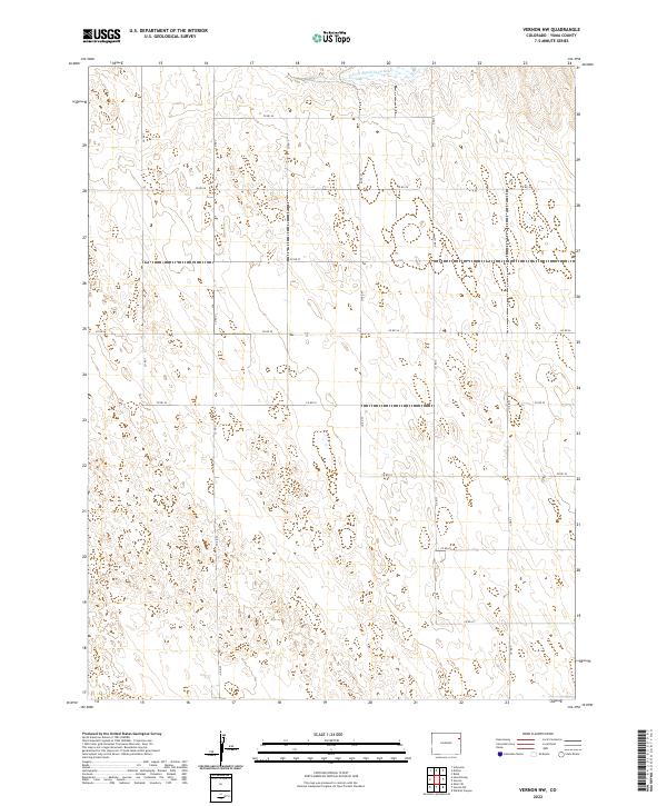
2022 Map of Vernon NW
USGS Topo · Published 2022About this map
The N Fork Republican River defines the northern edge of this high plains landscape in Yuma County, carving a subtle valley through an otherwise vast grid of agricultural sections. Recent decades have seen the area organized into a meticulous network of section-line roads, including Co Rd 29 and Co Rd 22, which facilitate the movement of goods and equipment across this remote corner of Colorado. The map reflects a modern rural infrastructure where north-south arteries like Co Rd T and Co Rd U provide the primary connection between isolated homesteads and larger regional hubs. This survey captures the intersection of the Public Land Survey System townships t1s r45w and t2s r46w, documenting the enduring geometry of the American West.
Find a feature on this map
19 named features on this map. Tap any name to fly to it.
Don’t see what you’re looking for? This feature index may not catch every label — zoom into the map to look around manually.
Map Details
Editions of this 2022 Vernon NW Map
This is the sole edition of this map. No revisions or reprints were ever made.
Other maps of this area

1954 · Limon
USGS Topo · 1:250,000

1954 · Sterling
USGS Topo · 1:250,000

1957 · Limon
USGS Topo · 1:250,000

1958 · Limon
USGS Topo · 1:250,000

1958 · Sterling
USGS Topo · 1:250,000

1961 · Eckley
USGS Topo · 1:24,000

1961 · Robb
USGS Topo · 1:24,000

1963 · Vernon
USGS Topo · 1:24,000

1963 · Wildcat Canyon
USGS Topo · 1:24,000

1968 · Abarr SE
USGS Topo · 1:24,000