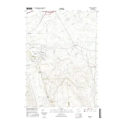
2016 Map of Vernon
USGS Topo · Published 2016About this map
Sherrill and Vernon anchor this 2016 survey of the Central New York landscape, where the border between Oneida Co and Madison Co follows the meandering path of Oneida Creek. The map documents a blend of compact urban grids and sprawling rural acreage, notably around the community of Kenwood and the historic Oneida Community Cem. To the north, Sconondoa Creek and Stony Cr drain the lower elevations toward Verona, while the southern terrain rises significantly toward the summit of Eaton Hill. This modern edition captures the persistent footprint of long-established settlements like Bennetts Corners and Valley Mills, alongside water features like Sunset Lake and the Sherrill Reservoir, illustrating how local industry and topography have shaped the region's development over the centuries.
Find a feature on this map
98 named features on this map. Tap any name to fly to it.
Don’t see what you’re looking for? This feature index may not catch every label — zoom into the map to look around manually.
Map Details
Editions of this 2016 Vernon Map
This is the sole edition of this map. No revisions or reprints were ever made.
Other maps of this area

1895 · Oriskany
USGS Topo · 1:62,500

1895 · Oneida
USGS Topo · 1:62,500

1898 · Oneida
USGS Topo · 1:62,500

1898 · Oriskany
USGS Topo · 1:62,500

1902 · Morrisville
USGS Topo · 1:62,500

1902 · Oneida
USGS Topo · 1:62,500

1907 · Sangerfield
USGS Topo · 1:62,500

1939 · Oneida
USGS Topo · 1:62,500

1943 · Morrisville
USGS Topo · 1:24,000

1943 · Sangerfield
USGS Topo · 1:62,500