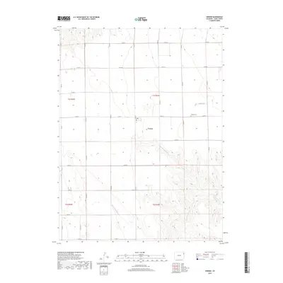
2019 Map of Vernon
USGS Topo · Published 2019About this map
Vernon serves as the central hub of this eastern Colorado landscape, a grid-based agricultural region where the high plains meet the headwaters of the Republican River drainage. The map illustrates a strictly ordered section-line road system, including Co RD 26 and Co RD DD, which provides access to the scattered farmsteads and rural infrastructure of Yuma County. In the eastern portion of the quadrangle, Glendale Cem and the local Po represent the community's civic and historical foundations. This human-made order gives way to natural complexity in the south and east, where the terrain is deeply dissected by the winding channels of N Fork Black Wolf Cr and S Fork Black Wolf Cr. These drainages eventually converge into Black Wolf Cr, creating a sharp contrast between the flat upland fields and the textured, dendritic drainage patterns that define the local topography.
Find a feature on this map
28 named features on this map. Tap any name to fly to it.
Don’t see what you’re looking for? This feature index may not catch every label — zoom into the map to look around manually.
Map Details
Editions of this 2019 Vernon Map
This is the sole edition of this map. No revisions or reprints were ever made.
Other maps of this area

1954 · Limon
USGS Topo · 1:250,000

1954 · Sterling
USGS Topo · 1:250,000

1957 · Limon
USGS Topo · 1:250,000

1958 · Limon
USGS Topo · 1:250,000

1958 · Sterling
USGS Topo · 1:250,000

1961 · Eckley
USGS Topo · 1:24,000

1961 · Robb
USGS Topo · 1:24,000

1961 · Wray
USGS Topo · 1:24,000

1963 · Vernon
USGS Topo · 1:24,000

1963 · Beecher Island
USGS Topo · 1:24,000