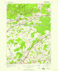
1955 Map of Verona
USGS Topo · Published 1957About this map
Wood Creek and the historical transport corridor of the Old Erie Canal define this mid-century landscape in Oneida County. The map documents a transition in infrastructure, showing the modern Erie Canal and New York Central railroad alongside older settlement patterns. Local history is deeply etched into the geography through numerous named corners, including Seifert Corners, Stooks Corners, and Cagwin Corners, reflecting a rural community structure built around key intersections. Military activity is prominent on the periphery, with the U S Military Reservation Jervis Test Site and the Verona Test Site established in the vicinity. Landmarks such as Fort Bull and the Sand Plains Chapel offer specific points of interest for genealogists and local historians tracking the development of Verona and the surrounding townships of Rome and Westmoreland.
Find a feature on this map
55 named features on this map. Tap any name to fly to it.
Don’t see what you’re looking for? This feature index may not catch every label — zoom into the map to look around manually.
Map Details
Editions of this 1955 Verona Map
3 editions found
Other maps of this area

1895 · Oriskany
USGS Topo · 1:62,500

1895 · Oneida
USGS Topo · 1:62,500

1898 · Oneida
USGS Topo · 1:62,500

1898 · Oriskany
USGS Topo · 1:62,500

1902 · Oneida
USGS Topo · 1:62,500

1904 · Boonville
USGS Topo · 1:62,500

1905 · Taberg
USGS Topo · 1:62,500

1939 · Oneida
USGS Topo · 1:62,500

1943 · Camden East
USGS Topo · 1:31,680

1943 · Lee Center
USGS Topo · 1:31,680