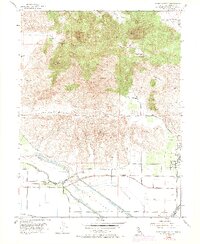
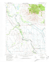
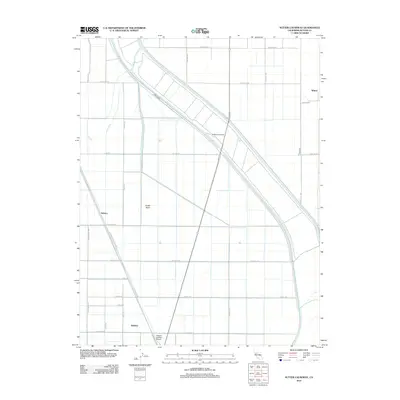
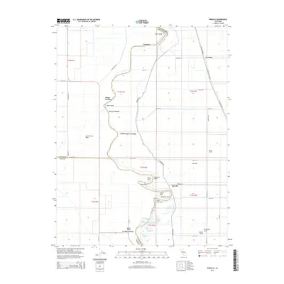
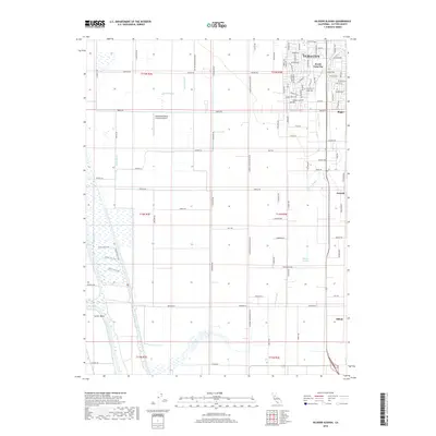
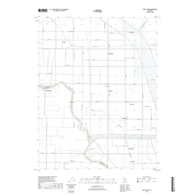
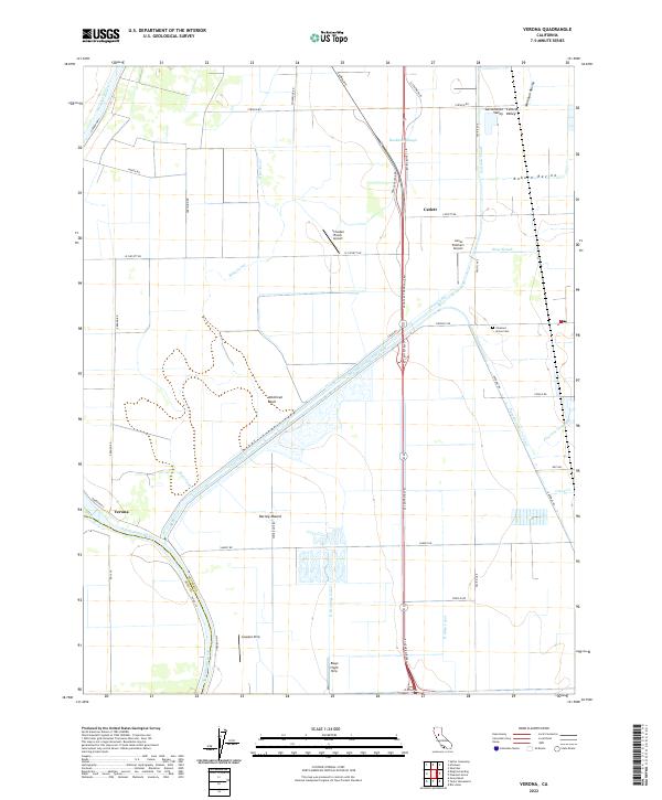
1967 Map of Verona
USGS Topo · Published 1985About this map
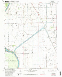
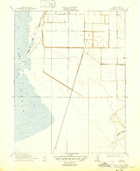
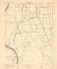
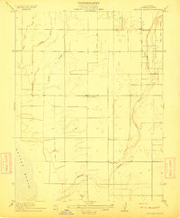
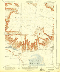
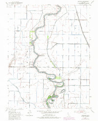
The Sacramento River and Feather River converge at the historic Verona settlement, defining a landscape dominated by complex water management and the agricultural expanse of the American Basin. This 1967 survey documents the critical infrastructure of the era, from the massive Sutter Bypass and Cross Canal to the Gaging Station and various pumping facilities. The region's transport history is visible in the route of the Western Pacific and the Sutter Basin Railroad, supporting local stops like Catlett and Pleasant Grove. Genealogists and local historians can locate established community centers such as the Pleasant Grove Sch and Pleasant Grove Cem, alongside river-based landmarks like Joes Landing and the Fremont Landing (Site). The map illustrates a transitional period where traditional river landings and rail sidings served a territory increasingly connected by the Garden Highway and the extensive canal network.
Find a feature on this map
41 named features on this map. Tap any name to fly to it.
Don’t see what you’re looking for? This feature index may not catch every label — zoom into the map to look around manually.
Map Details
Editions of this 1967 Verona Map
2 editions found

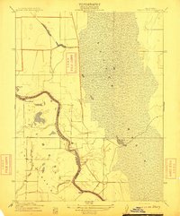
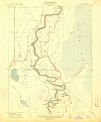
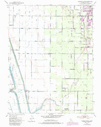
Historical Maps of Verona Through Time
38 maps found
1910 Marcuse
Sutter County, CA
1910 Vernon
Sutter County, CA
1911 Gilsizer Slough
Sutter County, CA
1912 Marysville Buttes
Sutter County, CA
1912 Tisdale Weir
Sutter County, CA
1915 Kirkville
Sutter County, CA
1952 Gilsizer Slough
Sutter County, CA
1952 Kirkville
Sutter County, CA
1952 Sutter Causeway
Sutter County, CA
1952 Tisdale Weir
Sutter County, CA
1952 Verona
Sutter County, CA
1954 Sutter Buttes
Sutter County, CA
1954 Sutter Buttes
Sutter County, CA
1967 Verona
Sutter County, CA
2012 Gilsizer Slough
Sutter County, CA

2012 Kirkville
Sutter County, CA
2012 Sutter Buttes
Sutter County, CA
2012 Sutter Causeway
Sutter County, CA
2012 Tisdale Weir
Sutter County, CA
2012 Verona
Sutter County, CA
2015 Gilsizer Slough
Sutter County, CA
2015 Kirkville
Sutter County, CA
2015 Sutter Buttes
Sutter County, CA
2015 Sutter Causeway
Sutter County, CA
2015 Tisdale Weir
Sutter County, CA

2015 Verona
Sutter County, CA
2018 Gilsizer Slough
Sutter County, CA
2018 Kirkville
Sutter County, CA
2018 Sutter Buttes
Sutter County, CA
2018 Sutter Causeway
Sutter County, CA
2018 Tisdale Weir
Sutter County, CA
2018 Verona
Sutter County, CA

2021 Sutter Buttes
Sutter County, CA
2021 Tisdale Weir
Sutter County, CA
2022 Gilsizer Slough
Sutter County, CA
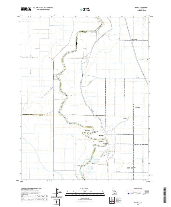
2022 Kirkville
Sutter County, CA
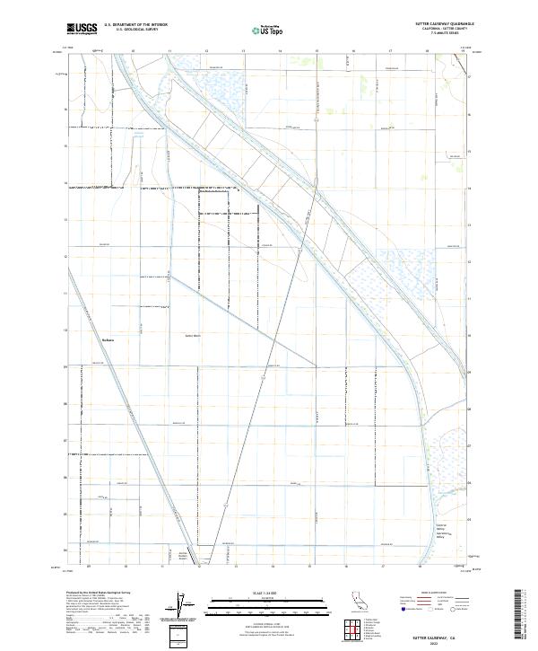
2022 Sutter Causeway
Sutter County, CA
2022 Verona
Sutter County, CA