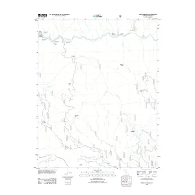
2012 Map of Verplank Ridge
USGS Topo · Published 2012About this map
The Kings River carves a deep path through this portion of Fresno County, where the landscape is defined by the high elevations of Verplank Ridge and McKenzie Ridge. This 2012 survey illustrates a transition from the river-level recreation areas like Gravel Flat Campground and Mill Flat Campground to the interior highlands. Named for earlier inhabitants and pioneers, locations such as Crabtree and Davis Flat are tucked into the drainages of Mill Flat Cr and Davis Cr.
Find a feature on this map
40 named features on this map. Tap any name to fly to it.
Don’t see what you’re looking for? This feature index may not catch every label — zoom into the map to look around manually.
Map Details
Editions of this 2012 Verplank Ridge Map
This is the sole edition of this map. No revisions or reprints were ever made.
Other maps of this area

1903 · Tehipite
USGS Topo · 1:125,000

1905 · Tehipite
USGS Topo · 1:125,000

1922 · Trimmer
USGS Topo · 1:96,000

1924 · Dinuba
USGS Topo · 1:125,000

1942 · Dunlap
USGS Topo · 1:62,500

1944 · Dunlap
USGS Topo · 1:62,500

1948 · Fresno
USGS Topo · 1:250,000

1952 · Tehipite Dome
USGS Topo · 1:62,500

1952 · Patterson Mountain
USGS Topo · 1:62,500

1955 · Fresno
USGS Topo · 1:250,000