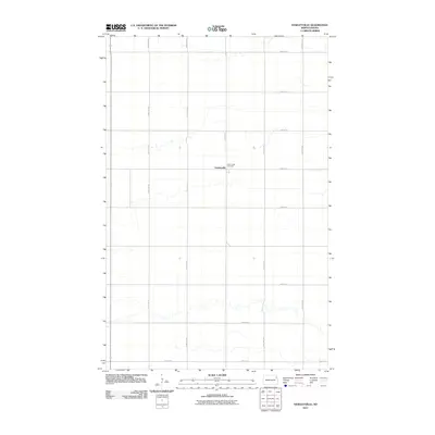
2011 Map of Veseleyville
USGS Topo · Published 2011About this map
Veseleyville serves as the focal point of this rural Walsh County landscape, reflecting the agricultural character of northeastern North Dakota in the early 21st century. The map depicts a grid of section-line roads, including County Rd-8 and 140th Ave NE, that organize the vast expanse of prairie farmland. A notable site of local heritage is Saint Lukes Cemetery, which stands just outside the main settlement area, providing a primary point of interest for genealogists tracing family histories in this tightly knit farming community. The drainage patterns of small, unnamed creeks wind through the township blocks, contrasting with the rigid geometry of the road network and property lines typical of the Red River Valley region.
Find a feature on this map
21 named features on this map. Tap any name to fly to it.
Don’t see what you’re looking for? This feature index may not catch every label — zoom into the map to look around manually.
Map Details
Editions of this 2011 Veseleyville Map
This is the sole edition of this map. No revisions or reprints were ever made.
Other maps of this area

1926 · Ardoch
USGS Topo · 1:62,500

1943 · Grafton
USGS Topo · 1:62,500

1952 · Thief River Falls
USGS Topo · 1:250,000

1956 · Thief River Falls
USGS Topo · 1:250,000

1957 · Thief River Falls
USGS Topo · 1:250,000

1960 · Grafton
USGS Topo · 1:24,000

1963 · Inkster NE
USGS Topo · 1:24,000

1963 · Pisek
USGS Topo · 1:24,000

1963 · Veseleyville
USGS Topo · 1:24,000

1963 · Nash
USGS Topo · 1:24,000