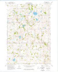
1974 Map of Veseli
USGS Topo · Published 1976About this map
The settlement of Veseli sits at the southern edge of this mid-1970s landscape, serving as a focal point for the surrounding rural townships of Wheatland, Webster, and Cedar Lake. The area is defined by a dense cluster of glacial lakes including Bradshaw Lake, Lennon Lake, and Nash Lake, which dictated the winding paths of local roads and the drainage of Porter Creek. Genealogy researchers will find the St Johns Cem clearly marked near the town center, along with a local Townhall and Radio Tower that anchored the community's civic life.
Find a feature on this map
23 named features on this map. Tap any name to fly to it.
Don’t see what you’re looking for? This feature index may not catch every label — zoom into the map to look around manually.
Map Details
Editions of this 1974 Veseli Map
This is the sole edition of this map. No revisions or reprints were ever made.
Other maps of this area

1953 · Saint Paul
USGS Topo · 1:250,000

1957 · Prior Lake
USGS Topo · 1:62,500

1957 · New Prague
USGS Topo · 1:62,500

1959 · Saint Paul
USGS Topo · 1:250,000

1960 · Lonsdale
USGS Topo · 1:24,000

1960 · Little Chicago
USGS Topo · 1:24,000

1966 · Montgomery
USGS Topo · 1:24,000
1974 · Prior Lake
USGS Topo · 1:24,000
1974 · New Market
USGS Topo · 1:24,000
1974 · Orchard Lake
USGS Topo · 1:24,000