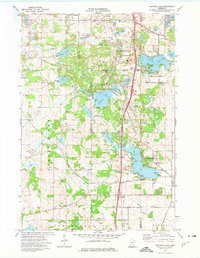
1974 Map of Orchard Lake
USGS Topo · Published 1976About this map
Burnsville and Lakeville emerge as growing suburban hubs in the mid-1970s, defined by a chain of glacial lakes and the expanding residential corridors of Orchard Garden and Argonne. The landscape is a mix of recreational development and lingering agricultural tracts, with numerous public spaces like Antlers Park on Marion Lake and Lakeside Park on Orchard Lake serving the local community. Significant infrastructure including the Chicago Milwaukee St Paul and Pacific railroad and Dodd Boulevard provide a framework for the region's connectivity.
Find a feature on this map
52 named features on this map. Tap any name to fly to it.
Don’t see what you’re looking for? This feature index may not catch every label — zoom into the map to look around manually.
Map Details
Editions of this 1974 Orchard Lake Map
2 editions found
Other maps of this area

1896 · Minneapolis
USGS Topo · 1:62,500

1896 · St. Paul
USGS Topo · 1:62,500

1901 · Minneapolis
USGS Topo · 1:62,500

1951 · St. Paul SW
USGS Topo · 1:24,000

1951 · St. Paul
USGS Topo · 1:62,500

1953 · Saint Paul
USGS Topo · 1:250,000

1954 · Bloomington
USGS Topo · 1:24,000

1954 · Eden Prairie
USGS Topo · 1:24,000

1954 · Minneapolis
USGS Topo · 1:62,500

1957 · Farmington
USGS Topo · 1:62,500