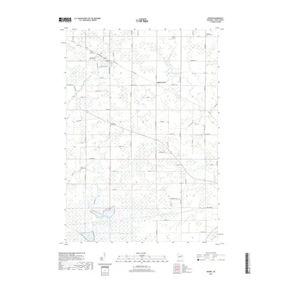
2018 Map of Vesper
USGS Topo · Published 2018About this map
Vesper and the small rural crossroads of Eight Corners anchor this 2018 survey of central Wisconsin, where the landscape is defined by a dense grid of local roads and winding waterways. The area is notable for its concentration of communal landmarks, particularly several cemeteries such as Trinity Cem, Saint Pauls Lutheran Cem, and Sigel Cem, which reflect the long-standing family and religious heritage of the township.
Find a feature on this map
75 named features on this map. Tap any name to fly to it.
Don’t see what you’re looking for? This feature index may not catch every label — zoom into the map to look around manually.
Map Details
Editions of this 2018 Vesper Map
This is the sole edition of this map. No revisions or reprints were ever made.
Other maps of this area

1953 · Eau Claire
USGS Topo · 1:250,000

1954 · Marshfield
USGS Topo · 1:62,500

1955 · Green Bay
USGS Topo · 1:250,000

1956 · Milladore
USGS Topo · 1:48,000

1957 · Wisconsin Rapids
USGS Topo · 1:48,000

1957 · Pittsville
USGS Topo · 1:48,000

1958 · Eau Claire
USGS Topo · 1:250,000

1964 · Eau Claire
USGS Topo · 1:250,000

1967 · Wisconsin Rapids
USGS Topo · 1:62,500

1967 · Pittsville
USGS Topo · 1:62,500