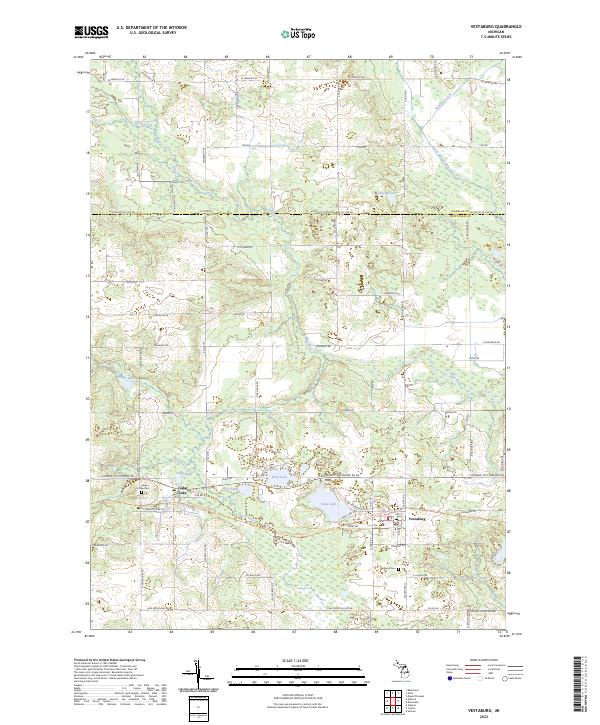
2023 Map of Vestaburg
USGS Topo · Published 2023About this map
Vestaburg and the settlement of Cedar Lake anchor this modern survey of eastern Montcalm County, where the landscape is defined by a dense network of glacial lakes and small watercourses. The Pine River and its tributaries, including Thatcher Creek and the North Branch Pine River, wind through the northern sections, while the southern half is dotted with significant bodies of water such as Bass Lake, Rock Lake, and Marl Lake. Genealogists will find the locations of Cedar Lake Cem and Richland Cem clearly marked relative to the residential blocks. The Fred Meijer Heartland Trl cuts across the center of the map, following a legacy transportation corridor that connects these rural communities. This survey provides a contemporary view of the region's transition from historic township divisions into a modern residential and recreational landscape.
Find a feature on this map
51 named features on this map. Tap any name to fly to it.
Don’t see what you’re looking for? This feature index may not catch every label — zoom into the map to look around manually.
Map Details
Editions of this 2023 Vestaburg Map
This is the sole edition of this map. No revisions or reprints were ever made.
Other maps of this area

1916 · Mount Pleasant
USGS Topo · 1:62,500

1919 · Mount Pleasant
USGS Topo · 1:62,500

1943 · Mount Pleasant
USGS Topo · 1:62,500

1954 · Midland
USGS Topo · 1:250,000

1958 · Midland
USGS Topo · 1:250,000

1959 · Midland
USGS Topo · 1:250,000

1964 · Edmore
USGS Topo · 1:24,000

1964 · Blanchard
USGS Topo · 1:24,000

1964 · Stanton
USGS Topo · 1:24,000

1965 · Vestaburg
USGS Topo · 1:24,000