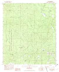
1982 Map of Vestry
USGS Topo · Published 1982About this map
De Soto National Forest and the University of Mississippi Forest dominate the landscape of the Jackson and George County line in this early 1980s provisional survey. The settlement of Vestry is a focal point of activity, situated near the intersection of Vestry Road and several timber-access routes. The terrain is characterized by a dense network of watercourses, including Little Red Creek and Bluff Creek, which flow through the protected wildlife areas. Rural life is evidenced by numerous family cemeteries and small congregations, such as Flurry Cem, Ramsey Cem, and Bonnie Chapel. The presence of the Red Creek State Wildlife Management Area highlights the region's dedication to conservation and timber management, while the inclusion of the Railroad and named tracks like Gator Road and Holland Road shows the infrastructure supporting local industry.
Find a feature on this map
48 named features on this map. Tap any name to fly to it.
Don’t see what you’re looking for? This feature index may not catch every label — zoom into the map to look around manually.
Map Details
Editions of this 1982 Vestry Map
2 editions found
Other maps of this area

1941 · Vancleave
USGS Topo · 1:62,500

1941 · Lucedale
USGS Topo · 1:62,500

1943 · Lucedale
USGS Topo · 1:62,500

1943 · Vancleave
USGS Topo · 1:62,500

1944 · Vancleave
USGS Topo · 1:62,500

1947 · Benndale
USGS Topo · 1:62,500

1949 · Benndale
USGS Topo · 1:62,500

1953 · Mobile
USGS Topo · 1:250,000

1954 · Vestry
USGS Topo · 1:62,500

1957 · Mobile
USGS Topo · 1:250,000