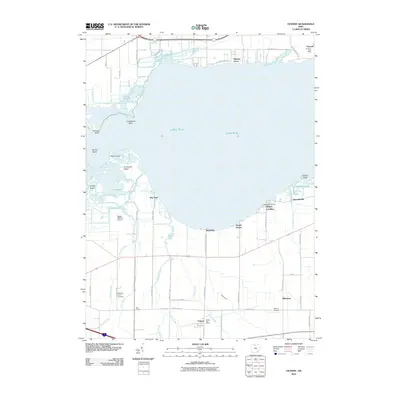
2010 Map of Vickery
USGS Topo · Published 2010About this map
Lake Erie defines the northern reaches of this coastal landscape, where the waters of Sandusky Bay meet a complex network of marshes and tributaries. The shoreline is punctuated by notable points and islands including Winous Point, Peach Island, and the aptly named Graveyard Island. This 2010 survey illustrates the deep integration of the local economy with the waterfront, from the maritime activity at Whites Landing and Bay Harbor Marina to the industrial presence of Gypsum and its Gypsum Post Office. Inland, the terrain is shaped by several waterways such as Pickerel Creek and Raccoon Creek, which feed into the extensive The Bogs. The map also captures several cultural landmarks important for local history, such as the McCreary Farm Cemetery, the Riley Grange, and the established village of Vickery, providing a clear view of the rural and residential character of the region at the start of the decade.
Find a feature on this map
54 named features on this map. Tap any name to fly to it.
Don’t see what you’re looking for? This feature index may not catch every label — zoom into the map to look around manually.
Map Details
Editions of this 2010 Vickery Map
This is the sole edition of this map. No revisions or reprints were ever made.
Other maps of this area

1900 · Oak Harbor
USGS Topo · 1:62,500

1901 · Put-In-Bay
USGS Topo · 1:62,500

1901 · Bellevue
USGS Topo · 1:62,500

1901 · Fremont
USGS Topo · 1:62,500

1903 · Bellevue
USGS Topo · 1:62,500

1903 · Fremont
USGS Topo · 1:62,500

1903 · Put In Bay
USGS Topo · 1:62,500

1952 · Lacarne
USGS Topo · 1:24,000

1952 · Oak Harbor
USGS Topo · 1:62,500

1956 · Toledo
USGS Topo · 1:250,000