2023 Map of Vickery
USGS Topo · Published 2023About this map
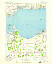
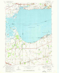
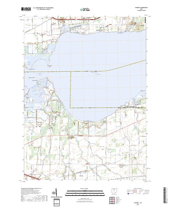
Sandusky Bay and the marshy northern edge of Sandusky Co define this 2023 landscape, where the waters of Lake Erie meet a complex network of coastal wetlands. The map details the transition from the open bay into the protected inlets of Muddy Creek Bay and the intricate channels surrounding Winous Point and Graveyard Island. Small lakeside communities like Bayshore, Sunset Harbor, and Whites Landing dot the shoreline, reflecting a region deeply connected to the lake's ecology and recreation. Inland, the terrain is dominated by agriculture and drainage systems like Scherz Ditch and Pickerel Creek. The settlement of Vickery serves as a hub for the surrounding rural area, which includes local historical markers such as the McCreery Farm Cem and aviation infrastructure at Boggy Bottoms Airport.
Find a feature on this map
50 named features on this map. Tap any name to fly to it.
Don’t see what you’re looking for? This feature index may not catch every label — zoom into the map to look around manually.
Map Details
Editions of this 2023 Vickery Map
This is the sole edition of this map. No revisions or reprints were ever made.
Historical Maps of Margaretta Township Through Time
3 maps found