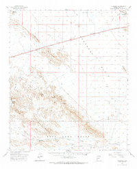
1962 Map of Vicksburg
USGS Topo · Published 1969About this map
Vicksburg anchors the northeastern corner of this arid landscape, situated along the At&SF rail line as the desert floor transitions into the Plomosa Mountains. The 1960s terrain is characterized by broad alluvial fans like the Rangras Plain and the winding course of Bouse Wash. To the south, the Kofa Game Range protects the New Water Mts, a region marked by geological curiosities such as The Eagles Eye and Gubsight Notch.
Find a feature on this map
29 named features on this map. Tap any name to fly to it.
Don’t see what you’re looking for? This feature index may not catch every label — zoom into the map to look around manually.
Map Details
Editions of this 1962 Vicksburg Map
2 editions found

Other maps of this area

1930 · Linskey
USGS Topo · 1:62,500

1942 · Blythe
USGS Topo · 1:250,000

1942 · Vicksburg
USGS Topo · 1:250,000

1954 · Salton Sea
USGS Topo · 1:250,000

1954 · Phoenix
USGS Topo · 1:250,000

1955 · Salton Sea
USGS Topo · 1:250,000

1957 · Phoenix
USGS Topo · 1:250,000

1958 · Phoenix
USGS Topo · 1:250,000

1959 · Salton Sea
USGS Topo · 1:250,000

1960 · Phoenix
USGS Topo · 1:250,000