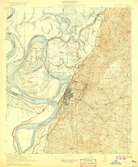
1918 Map of Vicksburg
USGS Topo · Published 1920About this map
Vicksburg and its strategic riverfront dominate this survey, which captures the complex hydrology of the Mississippi River and Yazoo River confluence. The landscape is defined by the sharp contrast between the floodplain to the west and the high Vicksburg Ridge to the east, where the Vicksburg National Military Park and National Cemetery are clearly delineated. Along the river's Old Channel, numerous agricultural sites such as Williams Plantations and Taylor Plantation sit near Little Cuba Landing, illustrating the region's deep plantation history. Significant civil engineering efforts are visible through the Diversion Canal and the historic Grants Canal, while the rail network including the Alabama and Vicksburg RR and Illinois Central RR marks Vicksburg as a vital southern transportation hub.
Find a feature on this map
77 named features on this map. Tap any name to fly to it.
Don’t see what you’re looking for? This feature index may not catch every label — zoom into the map to look around manually.
Map Details
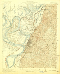
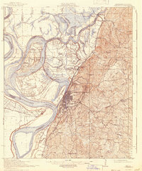
Editions of this 1918 Vicksburg Map
4 editions found
Other maps of this area

1909 · Millikens Bend
USGS Topo · 1:24,000

1909 · Mound
USGS Topo · 1:24,000

1910 · Mound
USGS Topo · 1:31,680

1918 · Vicksburg
USGS Topo · 1:62,500

1938 · Edwards
USGS Topo · 1:62,500

1939 · Onward
USGS Topo · 1:62,500

1939 · Talla Bena
USGS Topo · 1:62,500

1939 · Yokena
USGS Topo · 1:62,500

1939 · Alsatia
USGS Topo · 1:62,500

1940 · Mechanicsburg
USGS Topo · 1:62,500