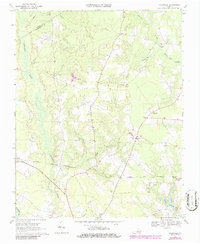
1969 Map of Vicksville
USGS Topo · Published 1986About this map
The Norfolk and Western railway cuts across this Southampton County landscape, connecting the small community of Sebrell in the west to Beales and Vicksville further east. This 1960s survey, updated in the mid-1980s, reveals a terrain defined by extensive wetlands and drainage systems, including the wide Assamoosick Swamp and the headwaters of the Nottoway R.
Find a feature on this map
20 named features on this map. Tap any name to fly to it.
Don’t see what you’re looking for? This feature index may not catch every label — zoom into the map to look around manually.
Map Details
Editions of this 1969 Vicksville Map
Other maps of this area

1919 · Homeville
USGS Topo · 1:48,000

1919 · Boykins
USGS Topo · 1:48,000

1920 · Holland
USGS Topo · 1:62,500

1920 · Ivor
USGS Topo · 1:62,500

1920 · Homeville
USGS Topo · 1:62,500

1920 · Boykins
USGS Topo · 1:62,500

1943 · Holland
USGS Topo · 1:62,500

1943 · Sebrell
USGS Topo · 1:31,680

1943 · Manry
USGS Topo · 1:31,680

1943 · Littleton
USGS Topo · 1:31,680