
1957 Map of Victoria
USGS Topo · Published 1960About this map
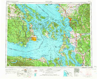
Orcas Island, San Juan Island, and Lopez Island anchor this coastal landscape, illustrating the intricate geography of the San Juan archipelago along the maritime border with Canada. On the mainland, the Great Northern and Northern Pacific railroads facilitate the movement of goods between ports like Bellingham and Everett. The strategic military presence in the late 1950s is evident through installations such as the Whidbey Island Naval Air Sta and coastal fortifications like Ft Worden Mil Res and Ft Flagler Mil Res guarding the entrance to Puget Sound. To the south, the massive expanse of the Olympic Mountains and Olympic National Park defines the peninsula, while tribal lands including the Tulalip Indian Reservation and Lummi Indian Res reflect the enduring heritage of the region's original inhabitants.
Find a feature on this map
70 named features on this map. Tap any name to fly to it.
Don’t see what you’re looking for? This feature index may not catch every label — zoom into the map to look around manually.
Map Details
Editions of this 1957 Victoria Map
4 editions found
Other maps of this area

1895 · Snohomish
USGS Topo · 1:125,000

1897 · Seattle
USGS Topo · 1:125,000

1899 · Stillaguamish
USGS Topo · 1:125,000

1901 · Stilaguamish
USGS Topo · 1:125,000

1906 · Sumas
USGS Topo · 1:62,500

1907 · Blaine
USGS Topo · 1:62,500

1908 · Sumas
USGS Topo · 1:62,500

1909 · Mt Baker
USGS Topo · 1:192,000

1911 · Mount Vernon
USGS Topo · 1:125,000

1915 · Mt. Baker
USGS Topo · 1:250,000