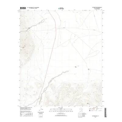
2016 Map of Victorio Peak
USGS Topo · Published 2016About this map
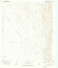
Victorio Peak dominates the high desert terrain of Culberson County, marking a landscape defined by sharp elevation changes and seasonal watercourses. This arid region in West Texas is characterized by the Baylor Mountains to the south and the dramatic incisions of Victorio Canyon and Bull Canyon further north. The map reveals the vital role of drainage in this environment, with Baylor Draw feeding into the rare catchment of Baylor Pond. Human imprint is sparse, limited primarily to isolated routes such as Wingo Rd and 2 Flat Rd that cross the wide flats between mountain ranges. These roads likely serve local ranching interests, connecting the vast, open spaces that define this portion of the Chihuahuan Desert.
Find a feature on this map
8 named features on this map. Tap any name to fly to it.
Don’t see what you’re looking for? This feature index may not catch every label — zoom into the map to look around manually.
Map Details
Editions of this 2016 Victorio Peak Map
This is the sole edition of this map. No revisions or reprints were ever made.
Other maps of this area

1906 · Van Horn
USGS Topo · 1:125,000

1954 · Van Horn
USGS Topo · 1:250,000

1958 · Van Horn
USGS Topo · 1:250,000

1964 · Watson Ranch
USGS Topo · 1:24,000
1964 · Sheep Peak
USGS Topo · 1:24,000
1964 · Nutt Ranch
USGS Topo · 1:24,000

1972 · Square Mesa
USGS Topo · 1:24,000
1973 · Victorio Peak
USGS Topo · 1:24,000

1973 · Apache Peak
USGS Topo · 1:24,000
1973 · Seven Heart Gap NW
USGS Topo · 1:24,000